Kenny DeMeurichy
People -> Where are they now? > Former Researchers >
Job Title: Terrestrial Laser Scanning Analyst & Research Technician Primary Affiliation: Department of Watershed Sciences Secondary Affiliation: Ecogeomorphology & Topographic Analysis Lab

Education
- 2004 BS. Geomatics Engineering. California State University, Fresno
Bio
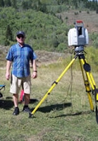
Kenny DeMeurichy, is a Terrestrial Laser Scanning (TLS) Analyst & Research Technician for the ET-AL at Utah State University. Kenny earned a degree in Geomatics Engineering from California State University, Fresno in 2004 and over ten years of professional surveying experience, including three years in terrestrial laser scanning. Kenny runs TLS (also known as ground-based LiDaR) and surveying field campaigns for the ET-AL. Kenny is also instrumental in providing training to USU students, workshop participants, and help supports the Columbia Habitat Monitoring Program.
Projects
CHaMP Surveying Protocol CHaMP Surveying Instructor CHaMP Total Station Data Analysis Developer CHaMP Multiple Survey Technology Data Integration Bridge Creek IMW Surveying Coordinator Bridge Creek IMW GIS Data Analysis 2014 Bridge Creek IMW Ice Breaker! GCD development team member ETAL and FHC Lab Support Archaeology, Sand Cliffs Signature Documentation, TLS
Scholarly Contributions
Reports
-
Jonathan M. Peart, Sara C. Shults, Kenneth P. Cannon, Kenny DeMeurichy, Molly Beka Cannon. Using 3D Laser Scanning Technology to Document the Sand Cliff Signatures Site Historic Inscriptions, Iron County, Utah. Utah Archaeology, 2013.
-
Bangen S, Wheaton JM and DeMeurichy KD. 2011. Methodological Intercomparison of Topographic & Aerial Photographic Habitat Survey Techniques. Ecogeomorphology and Topographic Analysis Lab, Utah State University, Prepared for Eco Logical Research and NOAA, Logan, Utah, 33 pp.
Utah State University Watershed Sciences Department 5210 Old Main Hill, NR 210 Logan UT 84322-5210
Office: JQL 147 Office Phone: 435-554-8492
