gis
Background
Introduction to Topic
In this week’s lectures we cover the fundamentals of coordinate surveying via either traditional total stations or GPS. These are the backbones to how all GIS data is collected (even imagery as we will see in lab).
Learning Outcomes
This fulfills course learning outcomes 2, 3, 4 & 5.
Lecture Materials
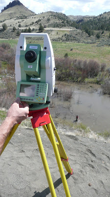
Field Surveying
- 2015 Tuesday Lecture - PDF
Past Years
- 2014 Tuesday Lecture - PDF
-
2013 Tuesday Lecture - PDF
- 2012 - RTKGPS 2012 Tuesday Lecture - PDF w/ 2 slides per page
- 2012 Tuesday Lecture - PDF w/ 6 slides per page
- 2012 Video of Lecture
Wrap - up GPS:
- 2012 Thursday Lecture - PDF w/ 2 slides per page
TLS
Ground-Based LiDaR or Terrestrial Laser Scanning Demo
- 2013 Tuesday Lecture - PDF
2012:
- 2012 Thursday Lecture - PDF w/ 2 slides per page
- 2012 Thursday Lecture - PDF w/ 6 slides per page
- 2012 Video of Lecture
Guest Lecture From Aggie Air’s Austin Jensen
Austin Jensen is with USU’s Aggie Air and talks to us about their drones on occasion. Here’s his lecture from 2012:

Additional Resources
Blimps & Drones
- Poor-Man’s Aerial Photography - A page about the blimp/helikite we use in lab
- Aggie Air Flying Circus -* Drones developed here at Utah State!*
- ECE 5930 - A whole class on deploying and designing platforms from blimps
- Buy your own blimp
- DJI Drones
Total Station Surveying:
-
Kenneth Cruikshank’s (Portland State University) “Use of the Electronic Total Station -I. Introduction and basic techniques” - Useful overview of total station surveying.
-
Kenneth Cruikshank’s Electornic Total Station Resources Pages- A number of links and tutorials that provide a basic understanding of how to use total stations (geared toward specific application with Sokkia Total Stations)
-
The Primary Total Station Manufacturers
GPS Surveying:
-
Garmin ‘What is GPS?’ - Nice consise overview of GPS
-
OPUS - Online Positioning User Service - Maintained by NOAA NGS for post processing GPS data
-
Some good ruggedized handheld map-grade GPS alternatives:
-
- Juniper Systems (here in Logan!)
- Leica
- Topcon
- Trimble
-
The Primary Survey-grade GPS Manufacturers
-