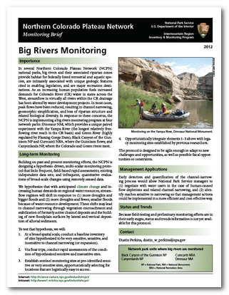
USGS - Big Rivers Monitoring Protocol Development
Project Type: Sponsored Research Project Sponsor: USGS & National Park Service Project Location: Dinosaur National Monument Status: Ongoing (through NPS: Assessment of Indicator Sites & Quantifying Short-Term Effects of High Flows on Riparian Vegetation along the Yampa & Green Rivers)
Project Overview
Purpose of Project:
This project was geared towards testing and developing a new way for monitoring the riparian coridors of big canyon-bound rivers (e.g. Yampa Gorge, Gates of Ladore). These rivers are very challenging to conduct monitoring in because of their remote nature and limited access (typically only by boat). They are also important natural and recreational resources that are very sensitive to potential changes in climate and flow regime.
Importance:
‘In several Northern Colorado Plateau Network (NCPN) national parks, big rivers and their associated riparian zones provide habitat for federally listed terrestrial and aquatic species, are intimately associated with unique geologic features cited in enabling legislation, and are major recreation destinations. As an increasing human population fuels increased demands for Colorado River (CR) water in states across the West, streamflow in virtually all rivers within the CR drainage has been altered by water development projects. In most cases, peak flows have been reduced, resulting in channel narrowing, geomorphic simplification, and loss of riparian structure and
related biological diversity. In response to these concerns, the NCPN is implementing a big rivers monitoring program at four network parks: Dinosaur NM, which provides a unique paired experiment with the Yampa River (the longest relatively freeflowing
river reach in the CR basin) and Green River (highly regulated by Flaming Gorge Dam); Black Canyon of the Gunnison NP and Curecanti NRA, where the Gunnison flows; and
Canyonlands NP, where the Colorado and Green rivers meet.’ - from Monitoring Brief
Dinosaur National Monument
Long-term Monitoring
‘Building on past and present monitoring efforts, the NCPN is designing a hypothesis-driven, multi-scalar monitoring protocol that links frequent, field-based rapid assessments; existing independent data sets; and infrequent, quantitative evaluations of broad-scale changes using remotely sensed data.
We hypothesize that with anticipated climate change and increasing human demands on regional water resources, streamflow regimes will shift in response to (1) more droughts and bigger floods and (2) more droughts and fewer, smaller floods because of water resource development. These shifts may lead to channel narrowing through vegetation encroachment and stabilization of formerly active channel deposits and the building of new floodplain surfaces by lateral and vertical deposition of alluvial sediments.’ - from Monitoring Brief
To test that hypothesis, we will:
- At a broad spatial scale, conduct a baseline inventory of sites hypothesized to be very sensitive, sensitive, and insensitive to channel narrowing (or expansion).
- Via float trips, conduct rapid assessments of the condition of hypothesized sensitive and insensitive sites.
- Establish sentinel monitoring sites at pre-identified sensitive or very sensitive sites, opportunistically selecting
- Opportunistically integrate elements 1–3 above with legacy monitoring sites established by previous researchers.
The protocol is designed to be agile enough to adapt to new challenges and opportunities, as well as possible fiscal opportunities or constraints.’ - from Monitoring Brief
Management Applications
‘Early detection and quantification of the channel-narrowing process would allow National Park Service managers to (1) negotiate with water users in the case of human-caused flow depletions and related channel narrowing, and (2) identify reaches sensitive to narrowing so that management actions could be implemented in a more efficient and cost-effective way.’ - from Monitoring Brief
Preliminary Conclusions / Future Work
The Big River Monitoring protocol is now actively being implemented and tested by the NPS, USGS and USU.
Related Links & Research
- NPS: Assessment of Indicator Sites & Quantifying Short-Term Effects of High Flows on Riparian Vegetation along the Yampa & Green Rivers
- USGS: Riparian Vegetation Analysis
- Northern Colorado Plateau Network
Project Outputs
Publications from this Project
- Manners RB, Schmidt J and **Wheaton JM. Accepted/Revisions in Review. Multi-scalar model for the determination of spatially explicit riparian vegetation roughness. Submitted to Journal of Geophysical Research - Earth Surface.
- Scott ML, Perkins DL and Wheaton J. 2012. Final Report: Big River Protocol Development – A Prototype Warranty Project, USGS, Fort Colins, CO, 198 pp.
Software or Tools from this Project
-
Big River Monitoring Protocol
-
- Scott ML, Perkins DL and Wheaton J. 2012. Final Report: Big River Protocol Development – A Prototype Warranty Project, USGS, Fort Colins, CO, 198 pp.
- Data Apps forthcoming
Datasets from this Project
-
TLS
-
- Deerlodge - 2010 & 2011
- Laddie Park - 2009 (whole site) & 2010 (patches only)
- Whirlpool - 2009 (whole site) & 2010 (patches only)
-
ALS (from different project)
-
- 2008
- 2010
- 2011 (river corridor throughout park)
Project Details
Project PI: Joseph Wheaton Project Personnel from ET-AL: Wally Macfarlane Project Collaborators: Micahel Scott (USGS), Dusty Perkins (NPS), Rebecca Manners (USU), Jack Schmidt (USU, USGS) Funding Source: USGS Project Start Date: **September, 2009 **Project End Date (anticipated): December, 2011

